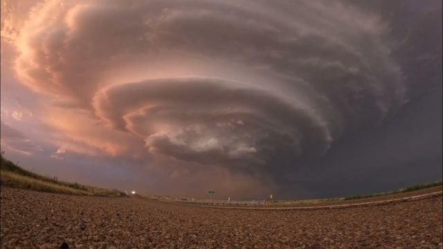
At the same time as a supercell was looming over central Oklahoma on Monday, May 6, tornado sirens began to sound. This was in anticipation of severe weather in the region.
Hennessy, located in Kingfisher County, was the location where storm chaser Matt Phelps acquired this clip, which shows heavy clouds and lightning approaching.
In the county, the storm caused damage to at least one home and one barn, as well as felled electricity poles, according to reports from the local news networks.
On the same day, a fatal EF-4 tornado struck the northeastern part of Oklahoma. The tornado, which had speeds of up to 175 miles per hour, was responsible for the death of one person.
An outbreak of storms in Oklahoma that resulted in fatalities has recently left a number of communities in a state of disarray. near the aftermath of the catastrophic storms, which included an EF-4 tornado that destroyed as many as seventy homes near Barnsdall, Oklahoma, on Monday night, families are now working to restore their homes.
Meteorologists have established that an EF-0 tornado was responsible for the severe winds that caused damage to a barn in Harvard that included two stories and resulted in the deaths of at least four animals and the entrapment of dozens more.
The footage from Tuesday, May 7, indicates that a tornado with winds of 85 miles per hour inflicted devastation to sections of the state of Indiana.
The National Weather Service (NWS) assigned the tornado a rating of EF-0, and according to accounts from the area, it wrecked a number of residences.
Images shot by a drone on Wednesday show the aftermath of the tornado that struck the area of Sellersburg, which is located north of Louisville, Kentucky. It is possible to see blue tarps covering the roofs of several of the dwellings.
Until Wednesday night, the National Weather Service (NWS) forecasted that the region would be subject to more storms.


