ALASKA – After an exceptionally snowy December, Alaska’s Panhandle is now facing the opposite extreme as torrential rain and warmer temperatures threaten rapid snowmelt and flooding across the region. Forecasters warn that an incoming atmospheric river could significantly increase flood risk through the weekend, particularly in and around Juneau.
Record December Snowfall Set the Stage
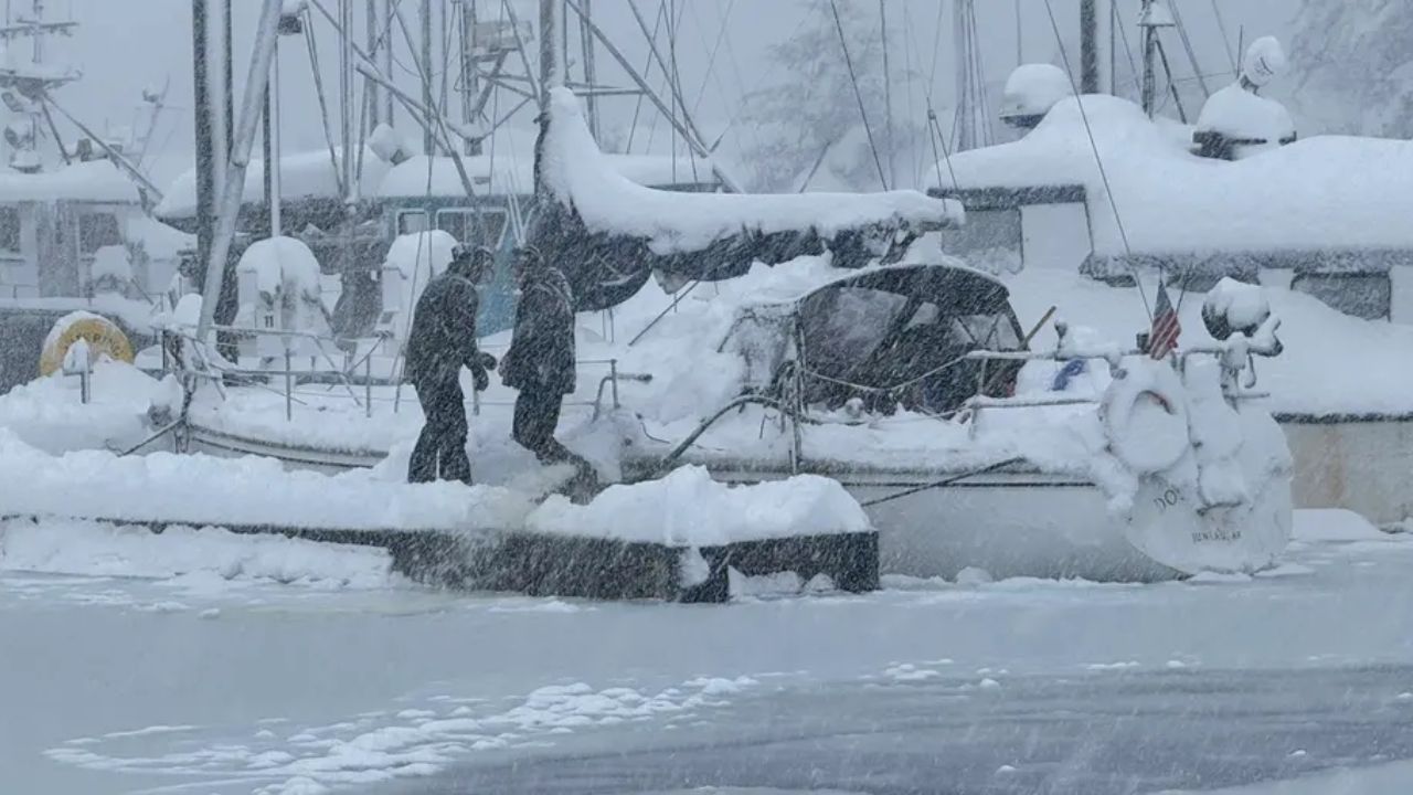
December 2025 brought unusually heavy snowfall to Southeast Alaska. Juneau typically receives between 40 and 50 inches of snow in December, but this past month shattered records with 82 inches, more than seven feet of accumulation.
The sheer volume of snow created serious impacts beyond land-based travel. In the Juneau harbor, large vessels sank under the weight of accumulated snow. U.S. Coast Guard officials explained that heavy snow can quickly compromise a vessel’s stability, increasing the risk of sinking, property damage, and potential pollution.
Atmospheric River to Bring Heavy Rain and Warm Air
An atmospheric river is expected to focus on the Alaska Panhandle from Friday into Saturday. As warmer air moves into the region, precipitation that may begin as snow in some locations is forecast to rapidly change over to rain by Friday afternoon.
According to the FOX Forecast Center, about three feet of snow remains on the ground in areas surrounding Juneau. When combined with sustained rainfall and rising temperatures, this snowpack could melt quickly, creating conditions favorable for flash flooding.
Flood Risk Heightened by Snowmelt and Blocked Drains
Forecasters warn that rapid snowmelt alone poses a significant flood risk, but additional hazards could make conditions worse. Snow and ice may block storm drains, preventing proper runoff and allowing water to pool in low-lying areas.
Rainfall totals are expected to reach 2 to 3 inches through the start of the weekend, with locally higher amounts—approaching 4 inches—possible in southern portions of the Panhandle.
Flood Watches Issued Across Southeast Alaska
In response to the growing threat, Flood Watches have been issued for a wide stretch of Southeast Alaska, including areas from Skagway through Juneau and southward to Ketchikan.
Residents in these areas are urged to monitor conditions closely, especially near rivers, streams, and known flood-prone zones.
More Rain Possible Into Next Week
The wet pattern may not end with the weekend. Meteorologists say additional rounds of rain are likely into early next week as multiple low-pressure systems move through the region, keeping soils saturated and prolonging flood concerns.
Officials continue to emphasize preparedness, as the combination of deep snowpack, heavy rain, and warming temperatures creates an elevated and evolving flood risk across Alaska’s Panhandle.