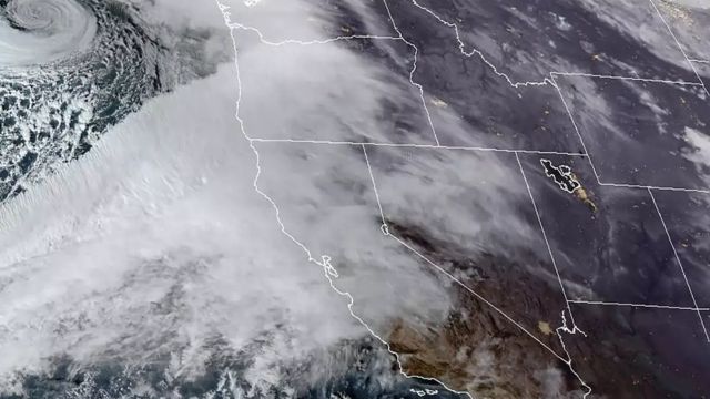
Numerous Flood Warnings and Advisories remain in effect for Memphis and much of the Mid-South region due to ongoing weather impacts.
In addition to the flooding concerns, the area is under a Slight Risk (Level 2 out of 5) for strong to severe thunderstorms on Thursday afternoon and evening. Residents should remain weather-aware as conditions evolve.
Tonight, skies will be clear once again, but temperatures will drop into chilly territory overnight. Expect lows in the upper 40s to low 50s, with light southerly winds at 5–10 mph keeping the air feeling crisp but not as cold as previous nights.
Thursday will begin with a bright start as sunrise occurs at 6:34 a.m. CT. The day will be partly sunny and milder, thanks to continued southerly flow. However, showers and thunderstorms are expected to develop during the afternoon and evening hours, particularly between 3 and 9 p.m. CT.
There is a slight chance that some of these storms could turn strong to severe, bringing gusty winds, hail, and heavy rainfall. Daytime highs will reach the upper 60s, with winds shifting slightly from the north-northeast at 5–10 mph.
Looking ahead, Friday will bring cooler and calmer weather, with mostly sunny skies and highs in the low 60s. The cool trend continues into Saturday, which will also be sunny with highs around 65 degrees.
Sunday sees a warm-up, with mostly sunny skies and milder temperatures nearing 75 degrees. Monday will be partly sunny and warm, with highs close to 80 degrees and a slight chance for scattered showers.
By Tuesday, sunshine returns in full, bringing mild temperatures in the low 70s.