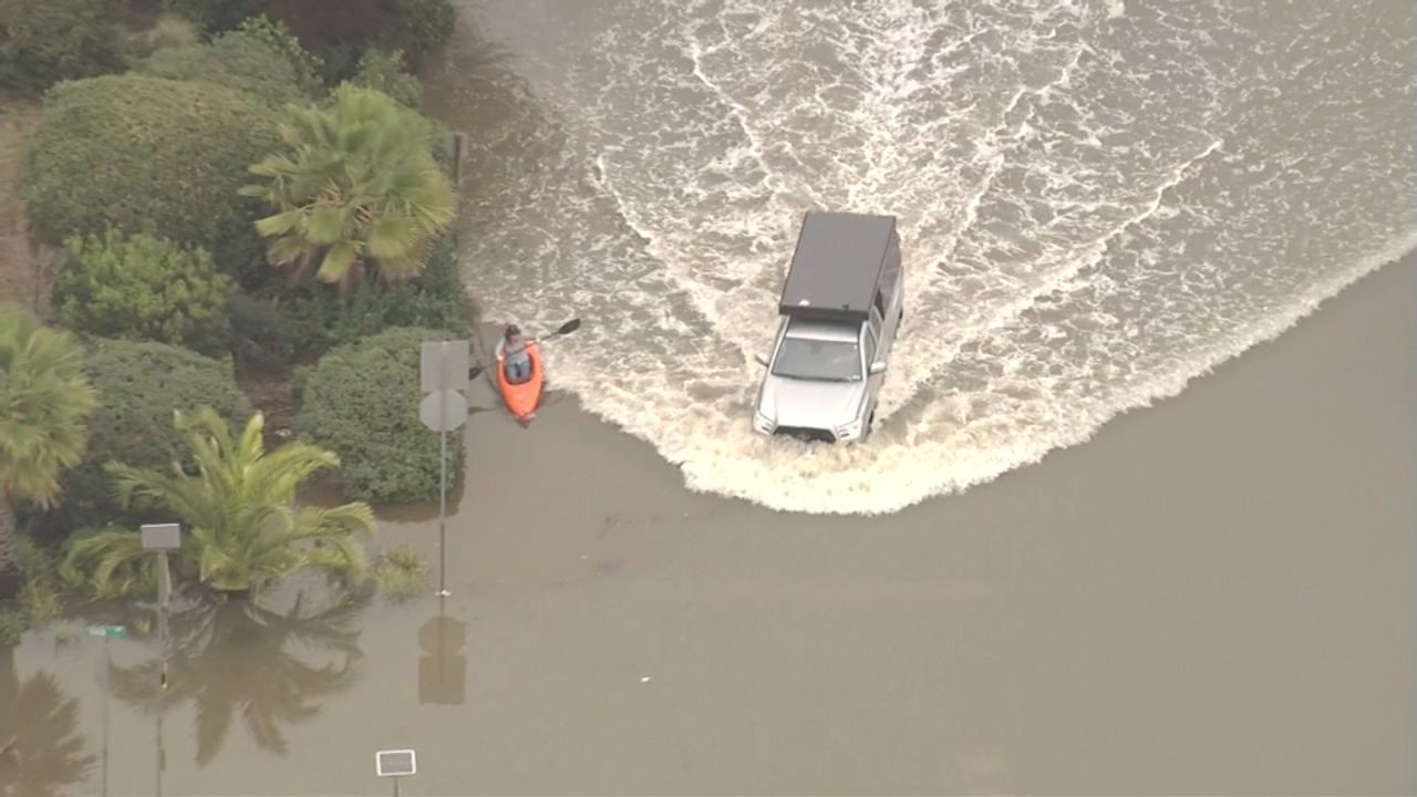
Flooding has already begun in parts of Marin County as the Bay Area braces for a combination of king tides and a strengthening storm system expected to worsen conditions through the weekend.
By midday Friday, a low-lying neighborhood near Lucky Drive and Dougherty Drive, close to Larkspur and Corte Madera, was inundated with floodwater. Aerial footage showed water covering roadways and surrounding properties, leaving some areas impassable.
At a Fitness SF location in Corte Madera, employees and residents were seen using buckets in an attempt to remove water from inside the building. The gym later confirmed on social media that the location has been temporarily closed due to flooding impacts.
Coastal Flood Warnings Issued Across the North Bay
The National Weather Service has issued a Coastal Flood Warning for shoreline areas and interior valleys of the North Bay, effective from 7 a.m. Friday through 2 p.m. Saturday. In addition, a Coastal Flood Advisory remains in effect for coastal regions stretching from Sonoma County south through Monterey County until Sunday afternoon.
Forecasters warn that the combination of high astronomical tides and storm surge could result in significant coastal flooding, particularly during the morning high tides on Friday and Saturday.
“Up to 2.5 feet of inundation above ground level is possible in low-lying areas near shorelines and tidal waterways,” the weather service said. “Numerous roads will be closed, and low-lying homes, businesses, and some critical infrastructure may be affected. Shoreline erosion is also expected.”
Rarely Seen Tide Levels Expected
At the San Francisco Tidal Gauge, forecasters reported that Friday’s high tide at 9:34 a.m. is expected to reach approximately 2.2 feet above normal. Conditions are forecast to intensify on Saturday, when the 10:26 a.m. high tide could climb to about 2.5 feet above normal—levels not seen in the region since 1998.
Sunday’s high tide, occurring at 11:18 a.m., is expected to be slightly lower but still elevated at roughly 1.9 feet above normal.
Meteorologists attribute the extreme tides to a convergence of factors, including a full moon on Saturday and perihelion, the point in Earth’s orbit when it is closest to the Sun. These astronomical influences are being amplified by forecast storm surge, which could add up to 1.3 feet of additional water.
Storm System to Bring Wind and Heavy Rain
Following a brief lull in rainfall Friday morning, a strong storm system is expected to move into the Bay Area late Friday night and persist into Saturday morning. The system is forecast to bring gusty winds and widespread rain, increasing the risk of flooding in already saturated and low-lying areas.
Sustained winds of 15 to 25 mph are expected across much of the region, with gusts reaching up to 50 mph along the coast and over higher terrain. Rainfall totals overnight are projected to average around half an inch in many locations, with coastal mountain areas potentially seeing up to 3 inches. Rain-shadowed valleys may receive closer to a quarter inch.
Because of the expected wind impacts, a Wind Advisory has been issued for the North Bay mountains, San Francisco, East Bay hills, coastal areas, and all of Monterey and San Benito counties. The advisory is in effect from 1 p.m. Friday through 1 p.m. Saturday.
Officials Urge Caution as Conditions Evolve
Emergency officials urge residents in flood-prone and coastal areas to avoid unnecessary travel during peak tide times, prepare for road closures, and secure property where possible. Motorists are advised not to drive through flooded roads, as water depth and roadway conditions can be difficult to judge.
With high tides, storm surge, strong winds, and rain all coinciding, forecasters say flooding impacts could expand beyond the coast into bayside neighborhoods and tidal waterways through the weekend. Residents are encouraged to monitor local alerts and be prepared for rapidly changing conditions.