Atlanta, Georgia – A fast-moving storm developing along an Arctic cold front later this weekend is expected to bring light snow and slippery travel conditions across parts of the Southeast and into portions of New England. While a major snowstorm is not anticipated, forecasters say snowflakes could fall as far south as Alabama and northern Florida, creating travel challenges in regions not well equipped for winter weather, according to AccuWeather.
Southeast Faces Elevated Travel Risks Despite Light Snow
Meteorologists say even minor snowfall can cause outsized impacts across the Southeast, where winter infrastructure is limited.
“Winter weather can have major travel impacts in the Southeast because the region has fewer plow trucks, salt supplies, and treatment resources than northern states,” said Dan Pydynowski, AccuWeather Senior Meteorologist.
Near the Gulf Coast late Saturday night, temperatures are expected to remain just warm enough to prevent snow from sticking to road surfaces. However, conditions change farther northeast, where the storm will strengthen as it moves across inland areas.
Georgia to Virginia Could See Steady Snow Sunday
From parts of Georgia into southeastern Virginia on Sunday, the storm may deliver several hours of steady snowfall. AccuWeather forecasts a coating to 1 inch of snow from southwestern Georgia through portions of Delaware, with a Local StormMax™ of up to 3 inches in isolated areas.
Road conditions could quickly deteriorate from wet to slushy or snow-covered, especially during brief periods of heavier snowfall.
“Even where roads look wet, temperatures dropping below freezing can turn those surfaces icy, creating dangerous driving conditions with little warning,” Pydynowski said.
“Drivers should slow down and use extra caution, especially on bridges and overpasses, which tend to freeze first.”
Atlanta and Charlotte Likely to Miss Heaviest Snow
Dry air farther northwest is expected to limit snowfall in major cities such as Atlanta and Charlotte. Forecasters note that snow may develop just southeast of Interstate 85 in the Carolinas, meaning even short-distance travel could bring sharply different road conditions.
Storm Expected to Strengthen Near the Northeast Coast
As the system tracks northward, its exact path and available moisture will determine snow totals across the mid-Atlantic and Northeast.
AccuWeather meteorologists expect little to no accumulation in Philadelphia, while New York City may see a coating to 1 inch, potentially enough to require aircraft deicing on Sunday. From eastern Maryland and southern Delaware through southern New Jersey, Long Island, and southeastern New England, a coating to a few inches of snow is likely.
Snow is forecast to spread north through the mid-Atlantic on Sunday, reaching the southern New England coast later in the afternoon or evening.
New England Braces for Airline Disruptions
The bulk of the snowfall in New England is expected Sunday night, a timing that could significantly impact air travel. Forecasters warn of airline delays and possible flight cancellations, particularly at major coastal airports.
Additional Snow From Midwest Clipper System
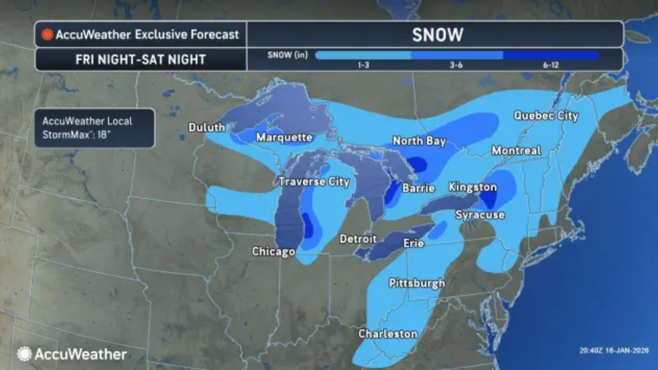
The coastal storm will follow a separate clipper system moving out of the Midwest earlier in the weekend. That system is expected to bring accumulating snow from the southern Appalachians in Tennessee and North Carolina through Pennsylvania, New Jersey, New York, and parts of New England.
Up to a few inches of snow are forecast in the Appalachian region. Philadelphia and New York City could see a light, slippery coating on Saturday, especially in northern and western suburbs, before the stronger coastal system arrives.


