Herkimer County, New York – The National Weather Service issued a winter weather advisory at 2:44 p.m. on Sunday, warning residents of Southern Herkimer County to prepare for hazardous winter conditions through midnight Monday as lake-effect snow moves into the region.
Forecasters say snow accumulations of up to 5 inches are possible in the most persistent lake-effect bands, accompanied by wind gusts reaching 35 mph, creating difficult travel conditions across parts of central New York.
What the National Weather Service Is Forecasting
According to the National Weather Service, a lake-effect snow band is expected to shift southward from the southern Adirondacks into the Mohawk Valley later Sunday evening. This movement could bring periods of heavy snowfall to areas that were previously seeing lighter conditions.
The advisory specifically highlights potential impacts along the New York State Thruway, where bursts of snow combined with gusty winds may lead to rapidly changing road conditions.
Meteorologists caution that snowfall intensity may vary dramatically over short distances.
Travel Conditions Expected to Deteriorate
Officials are urging drivers to plan ahead as roads are expected to become slick and visibility may drop quickly.
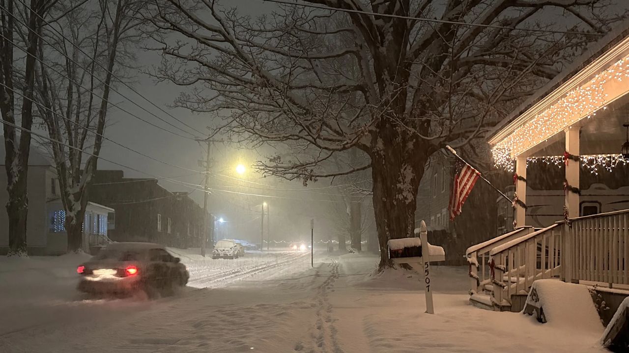
During lake-effect events, conditions can change within minutes. Some areas may experience locally heavy snowfall, while nearby locations remain mostly dry. These sharp contrasts increase the risk of sudden whiteout conditions, especially during evening and overnight hours.
Drivers are advised to reduce speed, increase following distance, and remain alert for changing weather patterns while traveling.
Why Lake-Effect Snow Is Especially Dangerous
Lake-effect snow systems are known for their unpredictability. Unlike widespread winter storms, these bands can stall over a single area for hours, leading to quick snow accumulation and reduced visibility.
Wind gusts can further worsen conditions by blowing snow across roadways, making it difficult for plows to keep surfaces clear and increasing the likelihood of icy patches.
Safety Tips for Residents and Motorists
The National Weather Service recommends taking extra precautions during the advisory period:
• Allow extra time for travel
• Keep headlights on during snowfall
• Avoid sudden braking or lane changes
• Carry an emergency winter kit in your vehicle
• Monitor local forecasts and road condition updates
Those who do not need to travel are encouraged to remain off the roads during periods of heavy snowfall.
What to Expect After the Advisory
The winter weather advisory remains in effect until Monday at midnight, after which conditions are expected to gradually improve as lake-effect bands weaken and shift out of the region. However, lingering snow showers and icy surfaces may still pose risks into early Tuesday.
Residents should continue monitoring weather updates and be prepared for rapidly changing conditions until the advisory expires.
Share your experiences or local conditions in the comments below.