We are continuing the week with another round of showers and thunderstorms.
Storm coverage today is much more limited compared to last week. Consider these storms very hit-or-miss. If you do see a storm, it can bring a quick, heavy downpour and frequent lightning strikes. Otherwise, it’s humid and hot with highs in the mid 90s.
Wednesday will be hot, dry, and hazy. Saharan dust has moved into our area which means we could see reduced air quality.
A 40% chance of cyclone formation looms. We’re monitoring a trough of low pressure near the southeastern coast, expected to move westward across Florida into the northeastern Gulf by Wednesday. This could bring heavy flooding to parts of Florida and the north-central Gulf Coast next week.
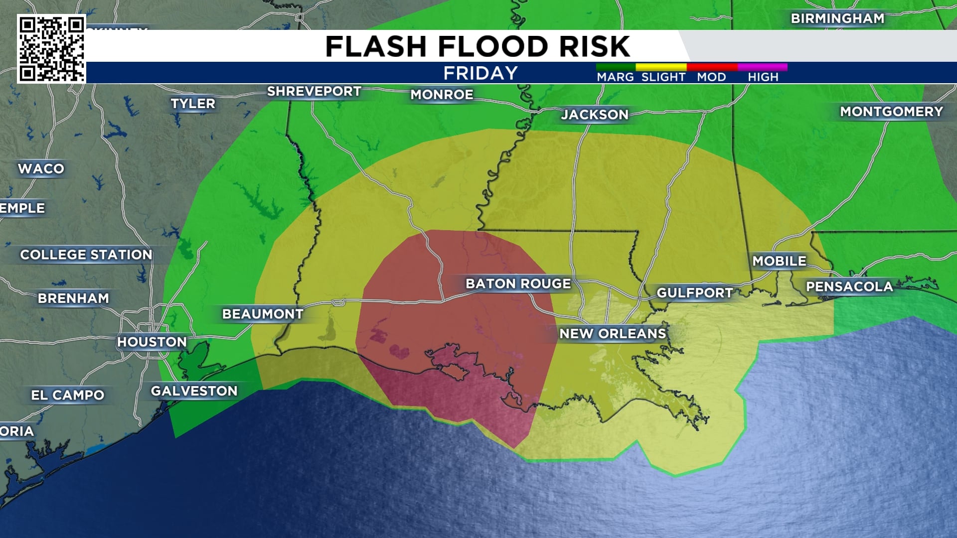
Although there is still a bit of uncertainty with this system, we can expect tropical moisture to surge at the end of the week. This will bring a flood threat to those east of I-45 on Friday and Saturday. The heaviest rainfall will be in Louisiana. Remember, if this system shifts further west, we can see the rainfall map shift with it.
Make sure your family is prepared for whatever comes our way this hurricane season.
Temperatures warm up mid week to the upper 90s as rain chances drop off. Rain chances return by the weekend.
It’s been a few year’s since we’ve had a summer weather pattern like the last few weeks of more than commonly stormy weather. Next week, we’ll finally start to string a few dry (albeit very hot) days together in a row. so you have a chance to get some of those outdoor projects done!
More Stories Like This In Our Email Newsletter